
Irine Falls(地貌 / 瀑布 / 泉水)
导语
Irine Falls(地貌 / 瀑布 / 泉水)位于梅鲁县,属于地貌 / 瀑布 / 泉水。页面重点包括Irine (Devil's Bridge) Falls is on the left hand side along the B6 Embu-Meru Road shortly after negotiating the infamous sharp corner at Ngonyi and shortly before arriving at Gikumeme Market,由此展开当地地理、交通、文化和旅行背景。
正文
地貌 / 瀑布 / 泉水(Irine Falls)位于梅鲁县,可作为了解当地自然空间的一处入口。它的价值不只在于“到此一游”的景点标签,更在于把梅鲁县的地理环境、城市生活、道路节点和地方记忆连接起来。
地貌 / 瀑布 / 泉水最值得关注的是生态环境、植被景观、城市绿地价值和现场游览体验。对旅行者来说,判断一个地方是否值得停留,关键不只是名称本身,而是它与周边道路、城镇和其他目的地之间的关系。放在一条县域线路中阅读,地貌 / 瀑布 / 泉水会显得更具体,也更容易被纳入实际行程。
从现有资料看,地貌 / 瀑布 / 泉水的吸引力主要来自现场环境和地方背景。它适合用较慢的节奏停留:观察空间本身,理解它与梅鲁县城市或乡村生活之间的关系,再结合照片和周边地点形成完整印象。
把地貌 / 瀑布 / 泉水放进肯尼亚旅行语境中,它补足的是主流 safari 线路之外的县域细节。这里呈现的不是单一动物观赏或酒店体验,而是更日常、更具体的地方肯尼亚:城市绿地、社区空间、自然边界、历史痕迹和道路连接共同构成了目的地的真实质感。
因此,地貌 / 瀑布 / 泉水适合作为梅鲁县目的地资料中的一页:它帮助读者快速理解这个地点的基本定位,也为规划区域停留、补充现场照片和串联周边路线提供参考。适合关注自然观察、轻徒步、亲子活动和地方生态教育的读者,都可以从这里获得一个可靠的起点。
英文原文
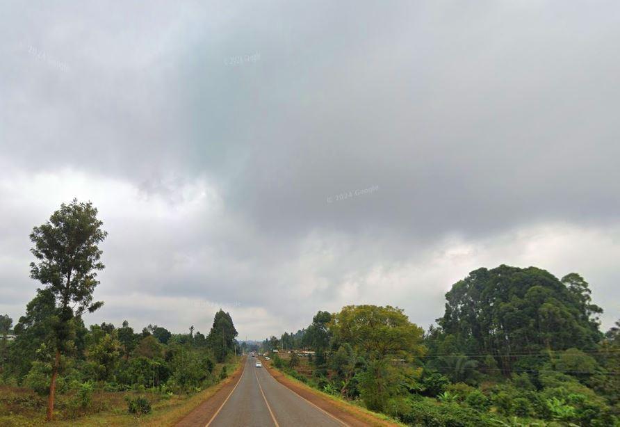
End to end the B6 Embu-Meru Road, leaving the A2 Nairobi-Nanyuki-Moyale Road at Makutano and rejoining it at Subuiga – halfway between Nanyuki and Isiolo – is an impressive road, as good, if not better than the more popular B5 Nyeri-Nyahururu Road, offering highland landscapes, stunning viewpoints and well-maintained infrastructure. The B6 travels halfway around Mount Kenya in Kirinyaga, Embu, Tharaka Nithi and Meru counties, respectively. It is this ample presence of the mountain and its associated geology that makes it a treat for the motorist. Beyond Chuka, 90 km from Makutano, the valley below the foot slopes of Mount Kenya forms a resplendent landscape, dipping gradually to the horizon.
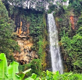
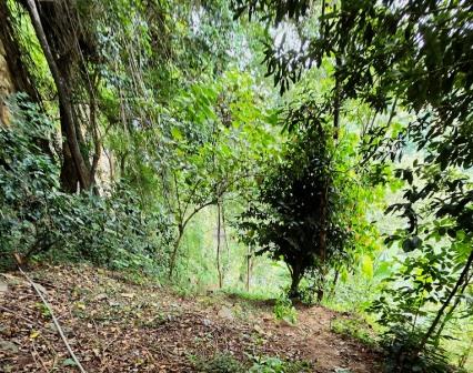
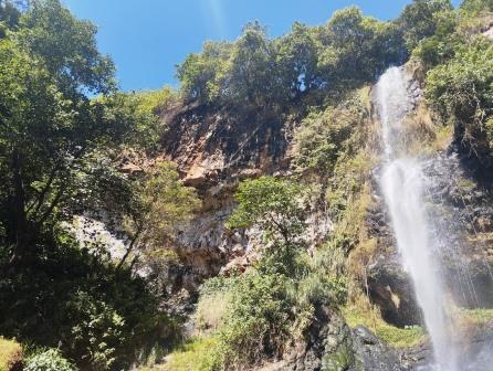
This whooper on the left hand side along the B6 Embu-Meru Road shortly after negotiating the infamous sharp corner at Ngonyi and shortly before arriving at Gikumeme Market. It is not signposted but can be sighted as you drive by. Irine Falls is accessed by means of a quick but steep pathway often with a rough mud caked underfoot to the base. It occurs on River Riiji that flows deep underneath the B6 Road, earning this road section, and sometimes the falls itself, the epithet of Devil’s Bridge. Locally known as the Ndurumo-ya-Irine, it spectacularly drops near perfect vertical from a great height of about 300 feet, without touching the cliff on the bottow half, turning to a misty gash nigh over the rock pool below.
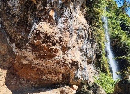
About 30 meters from the falls is a huge boulder upon which the water has cut through as River Riiji proceeds on its run. This rock is traditionally known as the “uroro-bwa-nkoma” or “ndaracha-ya-nkoma” also means devil’s bridge. In the olden days, the place was a salient source of red and white ochre, or nondoo in Kimeru language, used by various communities for decorating their bodies. This was also peculiarly used by women to draw a line on their heads when hosting community parties. In context of its topographic profile, the area around Nkubu marks the lowermost flows of Mount Kenya and Devil’s Falls occurs over one of the rarely exposed phonolites building up to a thickness of more than a 110 feet.
图片



Reply