
Sii Island(海滩 / 岛屿)
导语
Sii Island(海滩 / 岛屿)位于夸莱县,属于海滩 / 岛屿。页面重点包括The 3.2 km2 Sii Island lies to the far west of the Kisite-Mpunguti Islands, close to the Kenya-Tanzanian maritime boundary,由此展开当地地理、交通、文化和旅行背景。
正文
海滩 / 岛屿(Sii Island)位于夸莱县,可作为了解当地地方目的地的一处入口。它的价值不只在于“到此一游”的景点标签,更在于把夸莱县的地理环境、城市生活、道路节点和地方记忆连接起来。
海滩 / 岛屿最值得关注的是地理位置、到达方式、现场体验和周边可串联内容。对旅行者来说,判断一个地方是否值得停留,关键不只是名称本身,而是它与周边道路、城镇和其他目的地之间的关系。放在一条县域线路中阅读,海滩 / 岛屿会显得更具体,也更容易被纳入实际行程。
从现有资料看,海滩 / 岛屿的吸引力主要来自现场环境和地方背景。它适合用较慢的节奏停留:观察空间本身,理解它与夸莱县城市或乡村生活之间的关系,再结合照片和周边地点形成完整印象。
把海滩 / 岛屿放进肯尼亚旅行语境中,它补足的是主流 safari 线路之外的县域细节。这里呈现的不是单一动物观赏或酒店体验,而是更日常、更具体的地方肯尼亚:城市绿地、社区空间、自然边界、历史痕迹和道路连接共同构成了目的地的真实质感。
因此,海滩 / 岛屿适合作为夸莱县目的地资料中的一页:它帮助读者快速理解这个地点的基本定位,也为规划区域停留、补充现场照片和串联周边路线提供参考。适合希望理解肯尼亚县域目的地的读者,都可以从这里获得一个可靠的起点。
英文原文
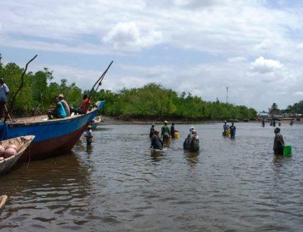
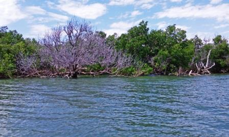
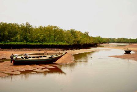
Sii, to the far west of the Kisite-Mpunguti Islands, close to the Kenya-Tanzanian maritime boundary, is a small island spanning 3.2 km2 with a coastline of 8.7 km. Remote, uncharted and unpeopled until the last decade, the mean population of Sii is 116 per km2. It is still a primitive enclave, covered by mangrove forests end to end. For generations it served as a refuge for the native communities, Wavanga and Wajimbo, in times of war and slavery. It has retained much of its floral appeal by escaping degradation and misuse thanks to its inaccessibility for small dhows.
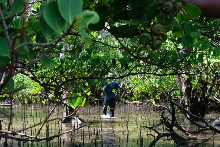
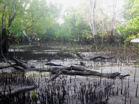
Still, the island is hard to live in. The mean elevation is just 5 m. The highest point on Sii Island reaches approximately 9 meters above sea level. That is to say, it is plain, flat, low-lying land that’s subject to the elements. Characterized by dense lush canopies of mangroves that retain their leaves year-round, it is also hard to find clearing for dwelling. These forests, typically tropical and subtropical, known for their biodiversity, also foster waterlogging. Sii Island has a tree cover of 97 %.
Today, the mangrove forests around Sii Island are the most intact and untainted within Kwale County. These forests provide protection to the contiguous fringing reefs which, in turn, serve as replenishment and spawning shelters for nearly 250 species of fish and about 124 coral species, yet, in recent years, the mangroves have been prone to illegal logging. The surrounding sea, too, is subject to illegal fishing activities such as seine netting and dynamite use by anglers from Tanzania.
The villages of Jimbo, Vanga and Kiwengu have proposed the protection of the forest through a local organization, VAJIKI (Vanga Jimbo Kiwengu) Community Forest Association. Mangroves within Kwale thrive in four key areas: Vanga-4265 ha, Funzi-2711 ha, Maftaha Bay-615 ha, and Ras Mwachema-5 ha. Together these form some of its most salient and highly productive coastal biospheres, defined by distinct wet and dry seasons with high temperatures year-round. Pronounced rainfall occurs during the wet season, while the dry season is marked by drought.
图片



Reply