
Nyambene Reserve(县域目的地)
导语
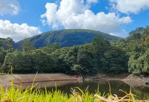
Nyambene Reserve(县域目的地)位于梅鲁县,属于县域目的地。页面重点包括The heavily wooded group of long hills and range rising to 2,500 metres (8,200 feet) at the highest elevation in the northern area of Meru County flie within the Nyambeni Forest Reserve,由此展开当地地理、交通、文化和旅行背景。
正文
县域目的地(Nyambene Reserve)位于梅鲁县,可作为了解当地地方目的地的一处入口。它的价值不只在于“到此一游”的景点标签,更在于把梅鲁县的地理环境、城市生活、道路节点和地方记忆连接起来。
县域目的地最值得关注的是地理位置、到达方式、现场体验和周边可串联内容。对旅行者来说,判断一个地方是否值得停留,关键不只是名称本身,而是它与周边道路、城镇和其他目的地之间的关系。放在一条县域线路中阅读,县域目的地会显得更具体,也更容易被纳入实际行程。
从现有资料看,县域目的地的吸引力主要来自现场环境和地方背景。它适合用较慢的节奏停留:观察空间本身,理解它与梅鲁县城市或乡村生活之间的关系,再结合照片和周边地点形成完整印象。
把县域目的地放进肯尼亚旅行语境中,它补足的是主流 safari 线路之外的县域细节。这里呈现的不是单一动物观赏或酒店体验,而是更日常、更具体的地方肯尼亚:城市绿地、社区空间、自然边界、历史痕迹和道路连接共同构成了目的地的真实质感。
因此,县域目的地适合作为梅鲁县目的地资料中的一页:它帮助读者快速理解这个地点的基本定位,也为规划区域停留、补充现场照片和串联周边路线提供参考。适合希望理解肯尼亚县域目的地的读者,都可以从这里获得一个可靠的起点。
英文原文
The heavily wooded group of long hills and range rising to 2,500 metres (8,200 feet) at the highest elevation in the northern area of Meru County flie within the Nyambeni Forest Reserve. The hills also add to the mosaic of views along one of the most pleasing drives in Isiolo County from the point of view of scenery. The range is elongated in a north-east to south-west strike from the slopes of Mount Kenya varying in height from a few hundred feet in the south to fifty feet or so to the north, in which direction it gradually disappears. The gneiss hills close to Isiolo have been eroded down to about 5,700 feet and thus are somewhat recessed.
Densely wooded, the distinct Nyambeni Range, a shield volcano, is capped by phonolite lava domes, basaltic cones, and lava flows of late-Pleistocene. This sequence of volcanic ash cones puys of Nyambeni Range remain unfamiliar to many, partly because travelling to this region was only previously made by few strong-minded trippers who had to brave the sultry, torrid, dusty and desolate region with roads in disrepair. Today, the Nyambeni Range is within easy reach via a newly laid road that will end up in Wajir. Beyond the range, the plains merges with moderate lava cones, which extend this bolster rugged puys to near Isiolo.
96 kms from Meru Town along B6 Embu-Meru Road, north along A2 Nanyuki-Isiolo Road, and then northeast along B9 Isiolo-Mandera Roads sits Nyambene Forest, originally gazetted as a 640 km2 forest reserve under Kenya legal notice and reestablished in 2002 as the 265 km2 Nyambene National Reserve. It is home to various sacred natural sites, diverse flora, unique landforms and rivers. Native communities have preserved their role and responsibilities, passed down over centuries by their ancestors, as custodians of these sacred shrines through time.
Groves in the 5391-hectare in Nyambene Forest are revered as sacred shrines to the Ameru community living along the northeastern slopes of Mount Kenya. “This is a resource from which customs, spiritual practices, and governance systems are derived to protect the territory as a whole and maintain its order, integrity and well-being” – Gloria Borana. Contiguous with the Samburu National Reserve and abutting with the Buffalo Springs National Reserve, the reserve is named after its highest hill, the most conspicuous geological feature that rises to about 2514 ms.
图片



Reply